You are here
Maps
InterRidge Vents Database Version 3.4:
Static map download in several formats at PANGAEA: https://doi.org/10.1594/PANGAEA.917894 (temporary link https://doi.pangaea.de/10.1594/PANGAEA.917894)
Static map download: JPG, PDF
Credits for static map: Jyun-Nai Wu (University of California San Diego), S. Beaulieu (Woods Hole Oceanographic Institution), and K. Szafranski (InterRidge), 2019; funding from U.S. National Science Foundation #1829773.
Data sources: InterRidge Vents Database Version 3.4, accessed 2019-12-24, with bathymetry from NOAA ETOPO1.
InterRidge Vents Database Version 3.3:
Interactive map (KML file) for download and display in Google Earth, produced from Version 3.3 on 16 Sept. 2015: vents_interridge_2015_active.kml
Credits for kml file: S. Beaulieu, Woods Hole Oceanographic Institution, 2015; funding from U.S. National Science Foundation #1202977.
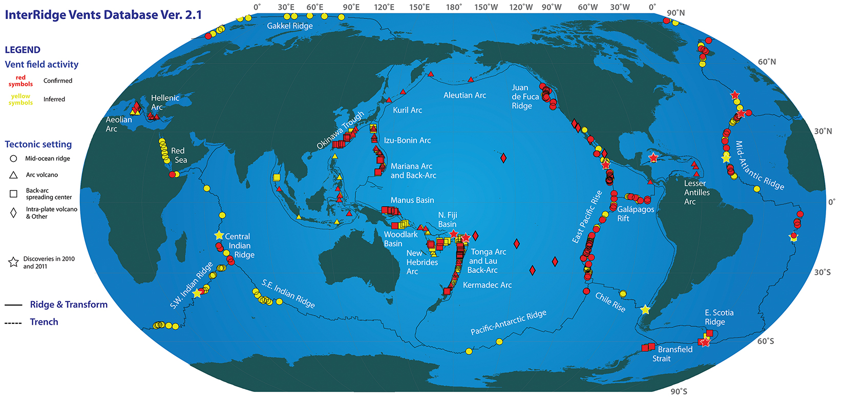
Old maps for InterRidge Vents Database Version 2.1:
Please note that the Version 2 database is at http://www.interridge.org/irvents/
Version 2.1 is also available in GeoMapApp > Datasets > Oceanic Hydrothermal Vents > Global Vent Distribution - InterRidge.
Interactive map (KML file) for download and display in Google Earth: vents_interridge_2011_all.kml
Static map download: JPG, PDF
Credits for static map: S. Beaulieu, K. Joyce, J. Cook, and S.A. Soule, Woods Hole Oceanographic Institution, 2015; funding from Woods Hole Oceanographic Institution, U.S. National Science Foundation #1202977, and InterRidge.
Data sources: InterRidge Vents Database, Version 2.1, release date 8 November 2011; University of Texas PLATES Project plate boundary shapefiles.
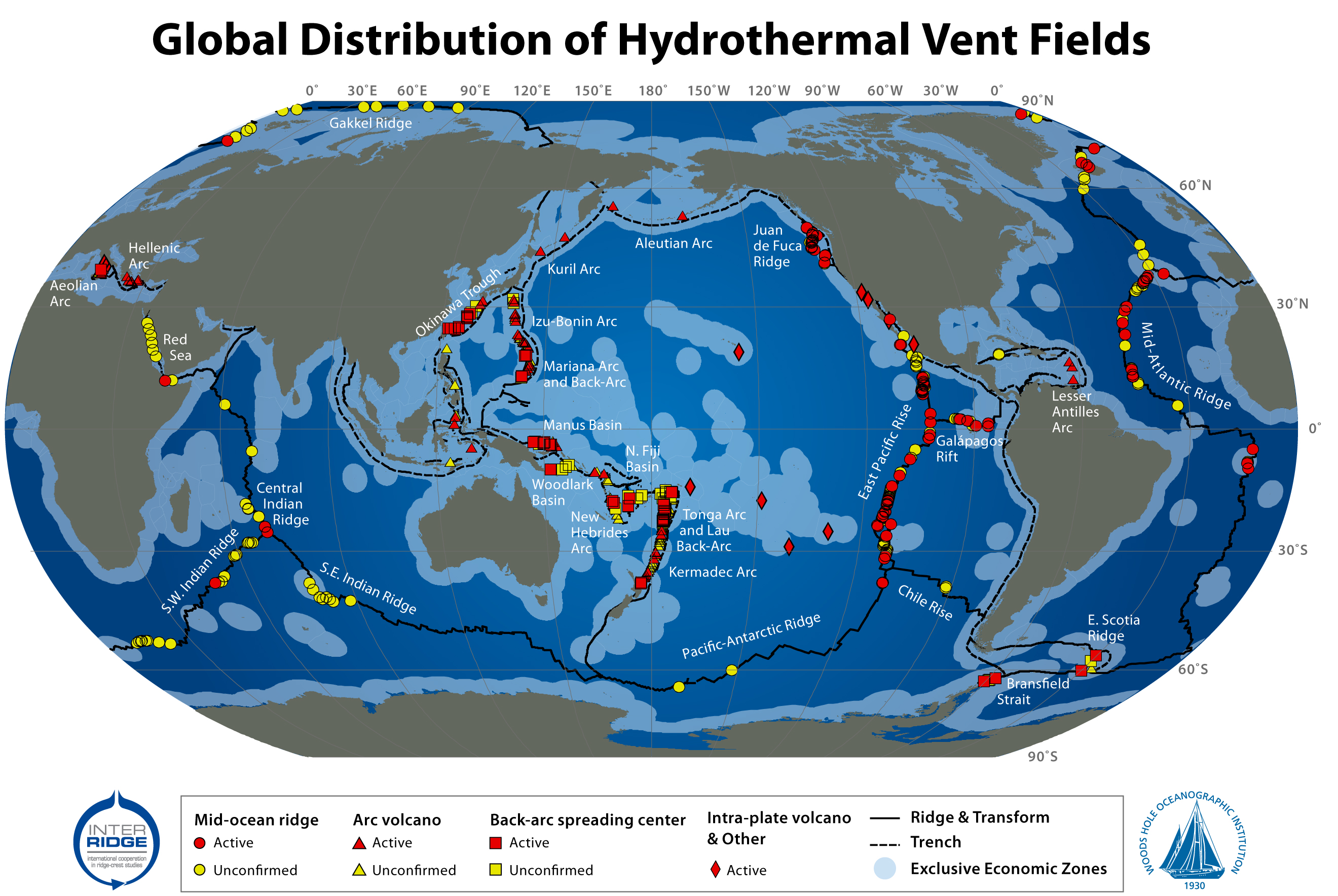
Older maps for the InterRidge Vents Database Version 2.0:
Static map download: JPG, PDF, EPS
Credits for static map: S. Beaulieu, K. Joyce, and S.A. Soule (WHOI), 2010; funding from InterRidge and Morss Colloquium Program at WHOI.
Data sources: InterRidge Vents Database, Version 2.0, release date 5 Mar. 2010; University of Texas PLATES Project plate boundary shapefiles; World EEZ GIS shapefiles, Version 5.0, Oct. 2009, from the VLIZ Maritime Boundaries Geodatabase.
Additional interactive map of interest:
The ChEss project of the Census of Marine Life utilized the InterRidge Vents Database Version 2.0 and other data sources to produce a tour of Deep-Sea Chemosynthetic Discoveries (click to download KML file).